SUBSCRIBE & WIN! Sign up for the Daily CHAT News Today Newsletter for a chance to win a $75 South Country Co-op gift card!

Hurricane rips roofs, cuts power in Bermuda, but no deaths

Sep 21, 2019 | 1:07 PM

MIAMI — Hurricane Humberto blew off rooftops, toppled trees and knocked out power as it blew past the British Atlantic island of Bermuda. But officials said Thursday that the Category 3 storm caused no reported deaths.

“We’ve made it through and everyone is safe,” Premier David Burt said. “That’s what is most important.”

Security Minister Wayne Caines said power had been restored to most customers by midday Thursday and emergency crews were clearing roads of power lines damaged by the hurricane, which had winds of about 120 mph (195 kph) at its nearest approach to the island Wednesday night.

Caines said government offices would reopen Friday, though schools would remain closed.

“The country is getting back on its feet and the good news is there was no loss of life,” he said.

The U.S. National Hurricane Center said Humberto had become a post-tropical cyclone out in the Atlantic, but would still kick up high surf at Bermuda and on the U.S. coast for a few days.

The storm had maximum sustained winds of 100 mph (155 kph) late Thursday, with tropical storm-force winds extending outward for 380 miles (610 kilometres). The storm was centred about 525 miles (845 kilometres) south-southwest of Cape Race, Newfoundland, and moving to the northeast at 20 mph (31 kph).

Meanwhile, a brush with land near Puerto Vallarta knocked newly formed Hurricane Lorena back down to tropical storm force, though forecasters said it would soon become a hurricane again on a track that would carry it close to the Los Cabos resorts at the tip of the Baja California Peninsula by midday Friday.

The storm’s centre came onshore in darkness in the western state of Colima, whipping palm trees about with its strong winds and lashing the area with sheets of rain.

Lorena flooded streets, washed out roads and touched off minor slides in 10 municipalities. Dozens of trees were downed, and there were power outages in some areas.

Water topped the banks of an arroyo and swamped some homes in the port city of Manzanillo, where 21 people sought refuge at a temporary shelter at a school, state Gov. José Ignacio Peralta said Thursday.

At an afternoon news conference, Peralta said nearly 8 inches (2 centimetres) of rain had fallen in a little under 24 hours, and more than 7,400 acres (3,000 hectares) of crops such as bananas and papayas were damaged statewide.

But there were no deaths or significant damage to infrastructure, he said.

“There are no losses of human lives to lament,” Peralta said.

Lorena had maximum sustained winds of 70 mph (110 kph) late Thursday and it was centred about 145 miles (235 kilometres) east-southeast of Cabo San Lucas. It was moving to the northwest at 12 mph (19 kph).

Forecasters said the storm could bring 5 to 10 inches (12.5 to 25 centimetres) of rain to parts of the region. Mexican officials voiced concern that some parts of southern Mexico, which have seen a lack of rainfall, could suffer dangerous flash floods and landslides unleashed by torrential rain.

Authorities in Los Cabos said schools would be closed Friday.

Another tropical storm, Mario, was also moving north across the Pacific farther out to sea. It was about 365 miles (590 kilometres) south of the southern tip of the Baja California Peninsula and had sustained winds of 65 mph (100 kilometres). It wasn’t expected to hit land, however.

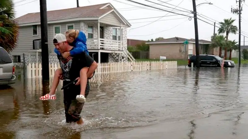
In Texas and Louisiana, heavy rains from the remains of Tropical Depression Imelda flooded low-lying areas and caused at least two deaths.

The National Weather Service said preliminary estimates suggested that Jefferson County in Texas got more than 40 inches of rain in a span of just 72 hours. That would make it the seventh wettest tropical cyclone in U.S. history.

Elsewhere in the Atlantic region, Jerry strengthened into a hurricane on a track that would carry it near the northern Leeward Islands on Friday and north of Puerto Rico on Saturday.

Its maximum sustained winds continued to strengthen, reaching 105 mph (165 kph) by late Thursday. It was centred about 385 miles (625 kilometres) east of the northern Leeward Islands and was moving to the west-northwest at 16 mph (26 kph).

The Associated Press