SUBSCRIBE & WIN! Sign up for the Daily CHAT News Today Newsletter for a chance to win a $75 South Country Co-op gift card!

Helene is upgraded to Category 2 hurricane as it barrels toward Florida

Sep 26, 2024 | 5:53 AM

TALLAHASSEE, Fla. (AP) — Helene strengthened into a Category 2 hurricane Thursday as it barreled across the Gulf of Mexico on a path to Florida.

The huge storm’s center is expected to make landfall in the Big Bend area of Florida’s northwestern coast as soon as late Thursday.

The storm is so large that areas roughly 90 miles (145 kilometers) north of the Georgia-Florida line could expect hurricane conditions. States as far inland as Tennessee, Kentucky and Indiana could see rainfall.

Helene became a tropical storm Tuesday in the western Caribbean Sea and became a hurricane Wednesday.

THIS IS A BREAKING NEWS UPDATE. AP’s earlier story follows below.

TALLAHASSEE, Fla. (AP) — Fast-moving Hurricane Helene was advancing Thursday across the Gulf of Mexico toward Florida, threatening an “unsurvivable” storm surge in northwestern parts of the state as well as damaging winds, rains and flash floods hundreds of miles inland across much of the southeastern U.S., forecasters said.

Helene is expected to be a major hurricane — meaning a Category 3 or higher — when it makes landfall on Florida’s northwestern coast Thursday evening. As of early Thursday, hurricane warnings and flash flood warnings extended far beyond the coast up into south-central Georgia. The governors of Florida, Georgia, and the Carolinas have all declared emergencies in their states.

The storm was expected to make landfall in the Big Bend region, where Florida’s panhandle and peninsula meet, according to Jack Beven, senior hurricane specialist at the National Hurricane Center in Miami.

“Regardless of how strong it is, it is a very large storm, Beven said. “It’s going to have impacts that cover a large area.”

The National Weather Service office in Tallahassee forecast storm surges of up to 20 feet (6 meters) and warned they could be particularly “catastrophic and unsurvivable” in Florida’s Apalachee Bay. It added that high winds and heavy rains also posed risks.

“This forecast, if realized, is a nightmare surge scenario for Apalachee Bay,” the office said. “Please, please, please take any evacuation orders seriously!”

In Crawfordville, farther inland and about 25 miles (40 kilometers) northwest of Apalachee Bay, Christine Nazworth stocked up on bottled water, baked goods and premade meals at a Walmart. She said her family would be sheltering in place, despite Wakulla County issuing a mandatory evacuation order.

“I’m prayed up,” she said. “Lord have mercy on us. And everybody else that might be in its path.”

Wakulla County was one of several to issue evacuation orders. Along Florida’s Gulf Coast, school districts and multiple universities have cancelled classes.

Early Thursday, Helene was about 350 miles (560 kilometers) southwest of Tampa and moving north northeast at 12 mph (19 kph) with top sustained winds of 90 mph (150 kph). Forecasters said it should become a Category 3 or higher hurricane, meaning winds would top 110 mph (177 kph).

While Helene will likely weaken as it moves inland, its “fast forward speed will allow strong, damaging winds, especially in gusts, to penetrate well inland across the southeastern United States,” including in the southern Appalachian Mountains, the hurricane center said. The center posted lesser tropical storm warnings as far north as North Carolina, and warned that much of the region could experience prolonged power outages, toppled trees and dangerous flooding.

Helene had swamped parts of Mexico’s Yucatan Peninsula on Wednesday, flooding streets and toppling trees as it passed offshore and brushed the resort city of Cancun.

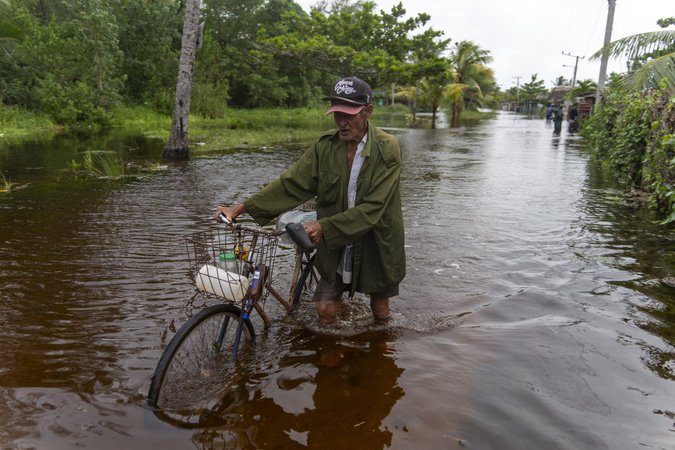
The storm formed Tuesday in the Caribbean Sea. In Cuba, the government preventively shut off power in some communities as waves as high as 16 feet (5 meters) slammed Cortes Bay. And in the Cayman Islands, schools closed and residents pumped water from flooded homes.

Rain was already falling steadily in Atlanta on Wednesday evening as shoppers emptied shelves of water at a Kroger supermarket east of downtown. The weather service in Atlanta issued flash flood warnings for much of the state.

Charles McComb said he still found it hard to believe Helene would seriously impact the city, which is more than 250 miles (400 kilometers) north of the Gulf of Mexico. “It would be really unique for it to hit so far inland,” Charles said as he bought water, bread and lunch meat.

He was, however, worried about losing electricity.

“I do live in an area where it doesn’t take so much for the power to go out,” he said.

Helene is forecast to be one of the largest storms in breadth in years to hit the region, said Colorado State University hurricane researcher Phil Klotzbach. He said since 1988, only three Gulf hurricanes were bigger than Helene’s predicted size: 2017’s Irma, 2005’s Wilma and 1995’s Opal.

Areas 100 miles (160 kilometers) north of the Georgia-Florida line can expect hurricane conditions. More than half of Georgia’s public school districts and several universities canceled classes.

For Atlanta, Helene could be the worst strike on a major Southern inland city in 35 years, said University of Georgia meteorology professor Marshall Shepherd.

Landslides were possible in southern Appalachia, and rainfall was expected as far away as Tennessee, Kentucky and Indiana.

Federal authorities have positioned generators, food and water, along with search-and-rescue and power restoration teams.

Helene is the eighth named storm of the Atlantic hurricane season, which began June 1. The National Oceanic and Atmospheric Administration has predicted an above-average Atlantic hurricane season this year because of record-warm ocean temperatures.

In further storm activity, Tropical Storm Isaac formed Wednesday in the Atlantic and was expected to strengthen as it moves eastward across the open ocean, possibly becoming a hurricane by the end of the week, forecasters said. Isaac was about 690 miles (1,115 kilometers) northeast of Bermuda with top sustained winds of 50 mph (85 kph), according to the hurricane center, which said its swells and winds could affect parts of Bermuda and eventually the Azores by the weekend.

In the Pacific, former Hurricane John reformed Wednesday as a tropical storm and was strengthening as it threatened areas of Mexico’s western coast. Officials posted hurricane warnings for southwestern Mexico.

John hit the country’s southern Pacific coast late Monday, killing at least two people, triggering mudslides, and damaging homes and trees. It grew into a Category 3 hurricane in a matter of hours and made landfall east of Acapulco. It reemerged over the ocean after weakening inland.

___

Hollingsworth reported from Mission, Kansas. Associated Press journalists Seth Borenstein in New York; Jeff Amy in Atlanta; Danica Coto in San Juan, Puerto Rico; Andrea Rodríguez in Havana; Mark Stevenson and María Verza in Mexico City; Claire Rush in Portland, Oregon; and Kate Payne in Crawfordville, Florida, contributed to this report.

Heather Hollingsworth And Stephen Smith, The Associated Press