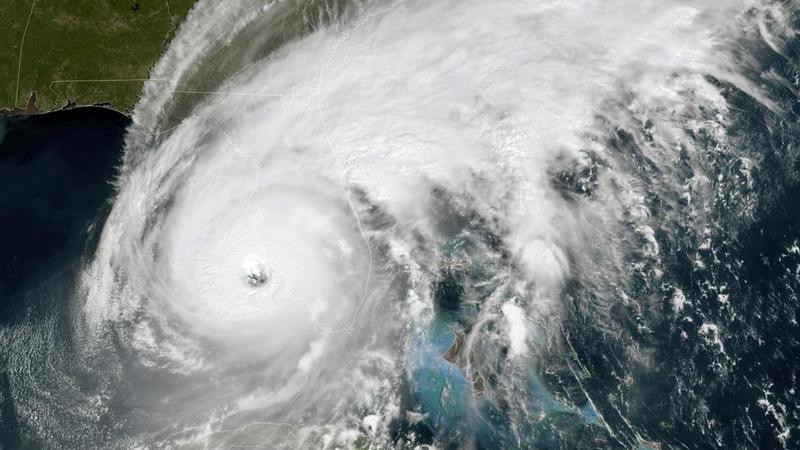
Ian makes landfall in southwest Florida as Category 4 storm
ST. PETERSBURG, Fla. (AP) — Hurricane Ian made landfall in southwest Florida near Cayo Costa on Wednesday as a catastrophic Category 4 storm.
About 2.5 million people were ordered to evacuate southwest Florida before the storm hit the coast with maximum sustained winds of 150 mph (241 kph). It was heading inland, where it was expected to weaken, at about 9 mph (14 kph), but residents in central Florida could still experience hurricane-force winds.
Before making its way through the Gulf of Mexico to Florida, Hurricane Ian tore into western Cuba as a major hurricane Tuesday, killing two people and bringing down the country’s electrical grid.
The center of the massive Category 4 storm lingered offshore for hours, which was likely to mean more rain and damage from a hurricane that was trudging on a track that would have it making landfall north of the heavily populated Fort Myers area. Catastrophic storm surges could push 12 to 18 feet (3.6 to 5.5 meters) of water across more than 250 miles (400 kilometers) of coastline, from Bonita Beach to Englewood, forecasters warned.

