SUBSCRIBE & WIN! Sign up for the Daily CHAT News Today Newsletter for a chance to win a $75 South Country Co-op gift card!

Latest track forecast for Teddy has storm on a course for Atlantic Canada

Sep 21, 2020 | 6:12 AM

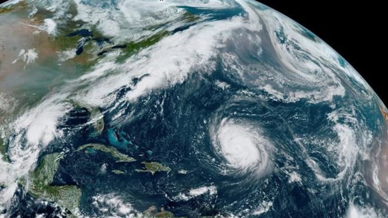
HALIFAX — Weather warnings have been issued for virtually all of Atlantic Canada as Hurricane Teddy advances toward the East Coast.

A tropical storm watch is now in effect for the Atlantic coastlines of mainland Nova Scotia and Cape Breton, where the storm could make landfall on Tuesday night.

Environment Canada says strong winds, heavy rain and pounding surf are in the forecast, with the storm’s expected track now encompassing all of mainland Nova Scotia and Cape Breton.

Though Teddy will likely transition to a post-tropical storm as it closes in on the region, it is expected to churn out gusts in excess of 80 to 100 kilometres per hour.

The highest rainfall amounts are likely to be north and west of Teddy’s eventual track, which is expected to take the storm over Nova Scotia, the eastern half of Prince Edward Island and over southwestern Newfoundland.

Rainfall amounts in these areas could exceed 50 millimetres, with some areas getting as much as 75 to 100 mm.

Rain ahead of Teddy will likely reach Nova Scotia by Tuesday afternoon and will continue in many areas into Wednesday.

Earlier this morning, the Category 2 hurricane was about 315 kilometres south-southeast of Bermuda, producing maximum sustained winds at 165 kilometres per hour.

This report by The Canadian Press was first published Sept. 21, 2020.

The Canadian Press